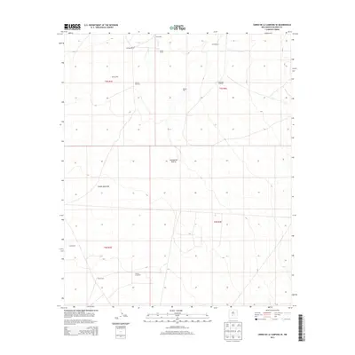
2013 Map of Cerro De La Campana SE
USGS Topo · Published 2013About this map
Jornada del Muerto defines the vast, arid character of this Socorro County landscape, a region historically shaped by the necessity of water access for ranching operations. The map documents a sparse but vital network of water sources, including specialized features like the Hunter Long Well, Bruton Well, and the Stock Pen Windmill. These points of interest, along with the Leo Windmill and Romero Wind Mill, illustrate the infrastructure required to sustain life and livestock in the high desert environment.
Find a feature on this map
17 named features on this map. Tap any name to fly to it.
Don’t see what you’re looking for? This feature index may not catch every label — zoom into the map to look around manually.
Map Details
Editions of this 2013 Cerro De La Campana SE Map
This is the sole edition of this map. No revisions or reprints were ever made.
Other maps of this area

1918 · Oscura Peak
USGS Topo · 1:125,000

1948 · Carthage
USGS Topo · 1:62,500

1948 · Granjean Well
USGS Topo · 1:62,500

1948 · Bingham
USGS Topo · 1:62,500

1948 · Mockingbird Gap
USGS Topo · 1:62,500

1954 · Tularosa
USGS Topo · 1:250,000

1958 · Tularosa
USGS Topo · 1:250,000
1981 · Greens Baber Well
USGS Topo · 1:24,000

1981 · Granjean Well
USGS Topo · 1:24,000
1981 · Trinity Site
USGS Topo · 1:24,000