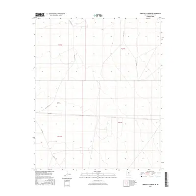
2017 Map of Cerro De La Campana SE
USGS Topo · Published 2017About this map
Canada Quemada defines the central topography of this high-desert expanse in Socorro County, where the landscape is organized by the rigid grid of the Public Land Survey System. The map records a sparsely developed area primarily shaped by modern military infrastructure, dominated by restricted access roads such as WSMR P Route 24 and WSMR S Route 3617. These routes cut through the various survey blocks, including t5s r3e and t6s r4e, tracing a path across a terrain marked by subtle elevation shifts and dry drainages. This 2017 edition document provides a clear view of the spatial organization of this specific corner of New Mexico, capturing the intersection of natural landforms and the strategic network of the White Sands region.
Find a feature on this map
9 named features on this map. Tap any name to fly to it.
Don’t see what you’re looking for? This feature index may not catch every label — zoom into the map to look around manually.
Map Details
Editions of this 2017 Cerro De La Campana SE Map
This is the sole edition of this map. No revisions or reprints were ever made.
Other maps of this area

1918 · Oscura Peak
USGS Topo · 1:125,000

1948 · Carthage
USGS Topo · 1:62,500

1948 · Granjean Well
USGS Topo · 1:62,500

1948 · Bingham
USGS Topo · 1:62,500

1948 · Mockingbird Gap
USGS Topo · 1:62,500

1954 · Tularosa
USGS Topo · 1:250,000

1958 · Tularosa
USGS Topo · 1:250,000
1981 · Greens Baber Well
USGS Topo · 1:24,000

1981 · Granjean Well
USGS Topo · 1:24,000
1981 · Trinity Site
USGS Topo · 1:24,000