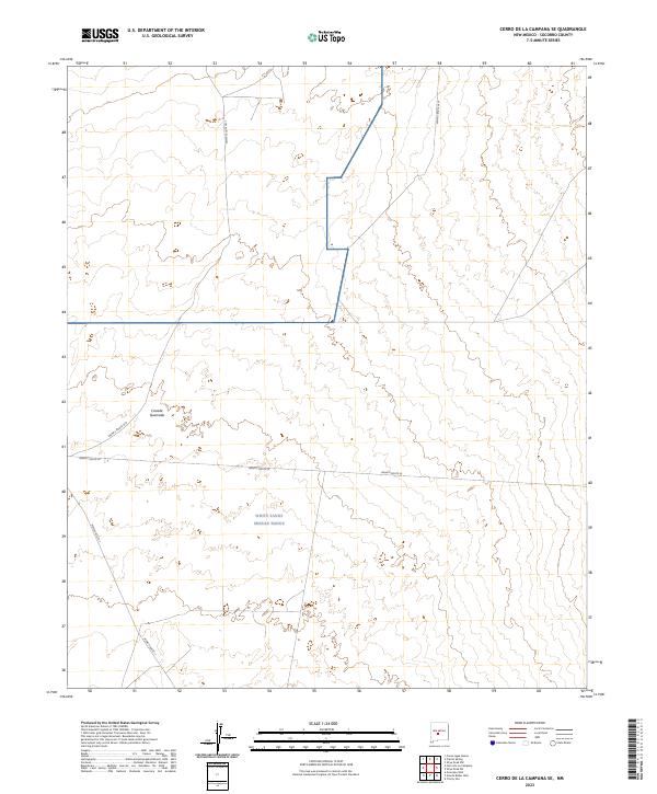
2023 Map of Cerro De La Campana SE
USGS Topo · Published 2023About this map
White Sands Missile Range dominates this portion of the Socorro County landscape, illustrating the intersection of military restriction and the high desert environment. The terrain is marked by significant topographical shifts, most notably at Canada Quemada, where the natural drainage patterns cut through the arid basin. This area is defined by its strictly controlled access, with a network of designated corridors such as WSMR P Route 24 and WSMR S Route 3617 providing the only structured movement through the vast sections of t5s r3e and t6s r4e. The layout of these routes, including WSMR P Route 7, reflects the logistical requirements of modern defense operations within a land primarily reserved for specialized government testing and research.
Find a feature on this map
10 named features on this map. Tap any name to fly to it.
Don’t see what you’re looking for? This feature index may not catch every label — zoom into the map to look around manually.
Map Details
Editions of this 2023 Cerro De La Campana SE Map
This is the sole edition of this map. No revisions or reprints were ever made.
Other maps of this area

1918 · Oscura Peak
USGS Topo · 1:125,000

1948 · Carthage
USGS Topo · 1:62,500

1948 · Granjean Well
USGS Topo · 1:62,500

1948 · Bingham
USGS Topo · 1:62,500

1948 · Mockingbird Gap
USGS Topo · 1:62,500

1954 · Tularosa
USGS Topo · 1:250,000

1958 · Tularosa
USGS Topo · 1:250,000
1981 · Greens Baber Well
USGS Topo · 1:24,000

1981 · Granjean Well
USGS Topo · 1:24,000
1981 · Trinity Site
USGS Topo · 1:24,000