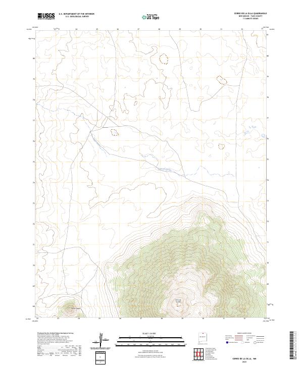
2023 Map of Cerro De La Olla
USGS Topo · Published 2023About this map
The volcanic topography of Taos County defines this landscape, dominated by the prominent shield volcano of Cerro de la Olla in the southern portion of the quadrangle. Most of the terrain is protected within the Río Grande del Norte National Monument, a vast high-altitude plateau characterized by sagebrush and volcanic features. To the west, the smaller volcanic cone of Cerrito Negro stands as a distinct landmark against the surrounding plains.
Find a feature on this map
10 named features on this map. Tap any name to fly to it.
Don’t see what you’re looking for? This feature index may not catch every label — zoom into the map to look around manually.
Map Details
Editions of this 2023 Cerro De La Olla Map
This is the sole edition of this map. No revisions or reprints were ever made.
Other maps of this area

1954 · Raton
USGS Topo · 1:250,000

1958 · Raton
USGS Topo · 1:250,000

1963 · Pinabetoso Peaks
USGS Topo · 1:24,000

1963 · Tres Piedras NE
USGS Topo · 1:24,000

1963 · Cerro De La Olla
USGS Topo · 1:24,000

1963 · Ute Mountain
USGS Topo · 1:24,000

1963 · Sunshine
USGS Topo · 1:24,000
1963 · La Segita Peaks NE
USGS Topo · 1:24,000
1963 · La Segita Peaks
USGS Topo · 1:24,000

1963 · Guadalupe Mountain
USGS Topo · 1:24,000