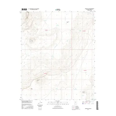
2017 Map of Cerro Del Oro
USGS Topo · Published 2017About this map
Cerro del Oro and Mesa del Oro rise from the high desert floor of Cibola County, defining a landscape shaped by intermittent water and traditional ranching infrastructure. This 2017 survey details a network of vital watering points necessary for livestock in this arid environment, including Horse Pasture Tank, Jonah Tank, and Lower Axtell Tank. The terrain is deeply incised by drainages such as Arroyo Colorado and Cañada de Aseyna, which carve paths toward the higher elevations of Gunn Mesa and the prominent Petaca Pinta in the northwest. Named springs like Salado Spring and Theodocio Spring indicate historical dependencies on natural water sources, while the presence of the Cañon Villa de Aseyna reflects the region's cultural heritage and land-use patterns long established in the New Mexico interior.
Find a feature on this map
32 named features on this map. Tap any name to fly to it.
Don’t see what you’re looking for? This feature index may not catch every label — zoom into the map to look around manually.
Map Details
Editions of this 2017 Cerro Del Oro Map
This is the sole edition of this map. No revisions or reprints were ever made.
Other maps of this area

1917 · Cerro Verde
USGS Topo · 1:125,000

1917 · Broom Mountain
USGS Topo · 1:125,000

1954 · Socorro
USGS Topo · 1:250,000

1958 · Socorro
USGS Topo · 1:250,000

1960 · Cerro Verde
USGS Topo · 1:24,000

1961 · Marmon Ranch
USGS Topo · 1:24,000
1961 · East Mesa
USGS Topo · 1:24,000

1962 · Socorro
USGS Topo · 1:250,000

1964 · Field Ranch
USGS Topo · 1:24,000
1964 · Cerro Del Oro
USGS Topo · 1:24,000