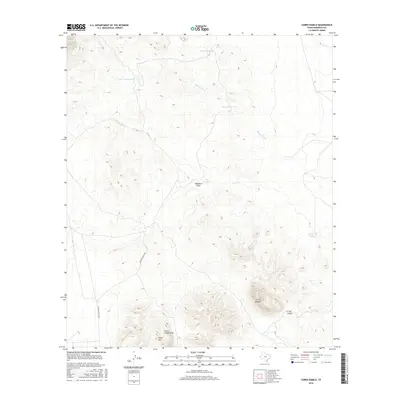
2016 Map of Cerro Diablo
USGS Topo · Published 2016About this map
Cerro Diablo and the Sierra Tinaja Pinta dominate this arid Hudspeth County landscape, illustrating a classic West Texas desert topography where water management is central to the human footprint. The map documents a network of named livestock tanks, such as Tank Number One, Peace Tank, and Bright Tank, which are essential for sustaining life and ranching operations in this water-scarce region. Arroyos and seasonal watercourses like Wasson Draw and Washburn Draw reveal the natural drainage patterns of the basin, showing how the land has been shaped by intermittent flash floods.
Find a feature on this map
12 named features on this map. Tap any name to fly to it.
Don’t see what you’re looking for? This feature index may not catch every label — zoom into the map to look around manually.
Map Details
Editions of this 2016 Cerro Diablo Map
This is the sole edition of this map. No revisions or reprints were ever made.
Other maps of this area

1903 · Cerro Alto
USGS Topo · 1:125,000

1943 · San Antonio Mtn
USGS Topo · 1:62,500

1954 · Carlsbad
USGS Topo · 1:250,000

1954 · Van Horn
USGS Topo · 1:250,000

1955 · Cerro Diablo
USGS Topo · 1:62,500

1958 · Van Horn
USGS Topo · 1:250,000

1958 · Carlsbad
USGS Topo · 1:250,000

1959 · Alamo Mountain
USGS Topo · 1:62,500
1970 · Shiloh Hills SE
USGS Topo · 1:24,000
1970 · Mc Veigh Hills
USGS Topo · 1:24,000