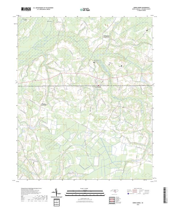
2022 Map of Cerro Gordo
USGS Topo · Published 2022About this map
Cerro Gordo serves as the central hub of this Columbus County landscape, where the rail line runs parallel to Main St and Railroad St W. The area is characterized by a complex network of wetlands and bays, including the extensive Dunn Swamp and Porter Swamp, which influence the winding paths of local routes like Rough and Ready Rd. These water features, such as Water Hole Bay and Robin Bay, create a fragmented pattern of land use typical of the Carolina coastal plain.
Find a feature on this map
94 named features on this map. Tap any name to fly to it.
Don’t see what you’re looking for? This feature index may not catch every label — zoom into the map to look around manually.
Map Details
Editions of this 2022 Cerro Gordo Map
This is the sole edition of this map. No revisions or reprints were ever made.
Other maps of this area

1943 · Pages Mill
USGS Topo · 1:62,500

1949 · Duford
USGS Topo · 1:24,000

1953 · Chadbourn
USGS Topo · 1:62,500

1953 · Florence
USGS Topo · 1:250,000

1954 · Florence
USGS Topo · 1:250,000

1962 · Fair Bluff
USGS Topo · 1:24,000

1962 · Fairmont
USGS Topo · 1:24,000
1962 · Tabor City West
USGS Topo · 1:24,000
1962 · Tabor City East
USGS Topo · 1:24,000

1962 · Fair Bluff
USGS Topo · 1:62,500