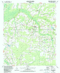
1986 Map of Cerro Gordo
USGS Topo · Published 1987About this map
Cerro Gordo serves as the central hub of this eastern North Carolina landscape, where the CSX railroad corridor dictates the placement of small communities and rural industry. The terrain is characterized by an intricate network of wetlands and "bays," including the sprawling Big Sandy Ridge Swamp, Robin Bay, and Meares Bay. This 1980s data reveals a traditional Southern settlement pattern anchored by crossroads and country churches such as Porter Swamp Ch, Mt Tabor Ch, and Mt Moriah Ch.
Find a feature on this map
40 named features on this map. Tap any name to fly to it.
Don’t see what you’re looking for? This feature index may not catch every label — zoom into the map to look around manually.
Map Details
Editions of this 1986 Cerro Gordo Map
This is the sole edition of this map. No revisions or reprints were ever made.
Other maps of this area

1943 · Pages Mill
USGS Topo · 1:62,500

1949 · Duford
USGS Topo · 1:24,000

1953 · Chadbourn
USGS Topo · 1:62,500

1953 · Florence
USGS Topo · 1:250,000

1954 · Florence
USGS Topo · 1:250,000

1962 · Fair Bluff
USGS Topo · 1:24,000

1962 · Fairmont
USGS Topo · 1:24,000
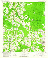
1962 · Tabor City West
USGS Topo · 1:24,000
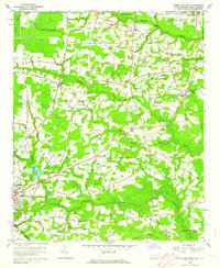
1962 · Tabor City East
USGS Topo · 1:24,000

1962 · Fair Bluff
USGS Topo · 1:62,500