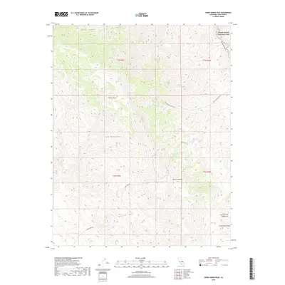
2018 Map of Cerro Gordo Peak
USGS Topo · Published 2018About this map
The Inyo Mountains define this high-altitude landscape, where the peaks separate the Mojave Desert from the surrounding basins. This terrain is marked by significant elevation changes, centered on the prominent Cerro Gordo Peak, which served as a landmark for the mining activity that once thrived in this region. Access to the heights is shown via the winding Cerro Gordo Rd and White Mountain Talc Rd, tracing the paths of resource extraction through the desert. Critical water sources like Mexican Spring and Cerro Gordo Spring are identified, highlighting the essential infrastructure for life in an arid environment. The map also captures the southeastern boundary of Death Valley National Park and unique geological formations such as Conglomerate Mesa and the Conglomerate Double Arch.
Find a feature on this map
16 named features on this map. Tap any name to fly to it.
Don’t see what you’re looking for? This feature index may not catch every label — zoom into the map to look around manually.
Map Details
Editions of this 2018 Cerro Gordo Peak Map
This is the sole edition of this map. No revisions or reprints were ever made.
Other maps of this area

1908 · Ballarat
USGS Topo · 1:250,000

1913 · Ballarat
USGS Topo · 1:250,000

1948 · Death Valley
USGS Topo · 1:250,000

1950 · Darwin
USGS Topo · 1:62,500

1950 · New York Butte
USGS Topo · 1:62,500

1950 · Ubehebe Peak
USGS Topo · 1:62,500

1951 · New York Butte
USGS Topo · 1:62,500

1951 · Darwin
USGS Topo · 1:62,500

1951 · Ubehebe Peak
USGS Topo · 1:62,500

1951 · Keeler
USGS Topo · 1:62,500