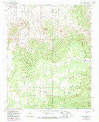
1961 Map of Cerro Parido
USGS Topo · Published 1989About this map
Sandoval Ranch, Ernest Montoya Ranch, and Joe Montoya Ranch anchor this landscape along the border of McKinley and Sandoval counties. This 1961 field-checked survey reveals a region defined by high-desert land grants and ranching operations. The Ignacio Chavez Grant Boundary runs through the central terrain, where the high elevations of Cerro Parido and Cerro Pelon overlook a complex network of arroyos and canyons.
Find a feature on this map
36 named features on this map. Tap any name to fly to it.
Don’t see what you’re looking for? This feature index may not catch every label — zoom into the map to look around manually.
Map Details
Editions of this 1961 Cerro Parido Map
2 editions found
Other maps of this area

1883 · Mt. Taylor
USGS Topo · 1:250,000

1886 · Mt. Taylor
USGS Topo · 1:250,000

1892 · Mt. Taylor
USGS Topo · 1:250,000

1899 · Mt. Taylor
USGS Topo · 1:250,000

1958 · Albuquerque
USGS Topo · 1:250,000

1961 · Cerro Parido
USGS Topo · 1:24,000

1961 · Cerro Tinaja
USGS Topo · 1:24,000

1961 · El Dado Mesa
USGS Topo · 1:24,000

1961 · Mesita Del Gavilan
USGS Topo · 1:24,000

1961 · Arroyo Empedrado
USGS Topo · 1:24,000