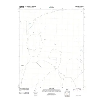
2010 Map of Cerro Pomo
USGS Topo · Published 2010About this map
Cerro Pomo rises as a central landmark in this high-desert landscape of New Mexico, situated within the Eastern Navajo Agency. The 2010 terrain is defined by a series of volcanic-like peaks and ridges, including Cerro Cantina, Cerro Montoso, and the prominent Penasco Ridge. This map documents a sparsely populated but active ranching or grazing environment, as evidenced by the distribution of family-named landmarks and water sources.
Find a feature on this map
15 named features on this map. Tap any name to fly to it.
Don’t see what you’re looking for? This feature index may not catch every label — zoom into the map to look around manually.
Map Details
Editions of this 2010 Cerro Pomo Map
This is the sole edition of this map. No revisions or reprints were ever made.
Other maps of this area

1954 · Saint Johns
USGS Topo · 1:250,000

1957 · Saint Johns
USGS Topo · 1:250,000

1958 · Saint Johns
USGS Topo · 1:250,000

1962 · Saint Johns
USGS Topo · 1:250,000

1967 · Red Lake Mission
USGS Topo · 1:24,000
1967 · Cerro Brillante
USGS Topo · 1:24,000

1967 · Chimney Hill
USGS Topo · 1:24,000

1967 · Cerro Alto
USGS Topo · 1:24,000

1967 · Veteado Mountain
USGS Topo · 1:24,000
1967 · Cerro Pomo
USGS Topo · 1:24,000