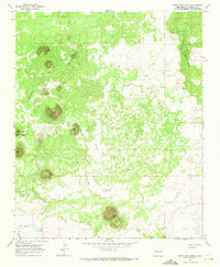
1967 Map of Cerro Brillante
USGS Topo · Published 1971About this map
The Continental Divide winds through this high-altitude landscape in New Mexico, separating the watersheds of the American West. The eastern edge of the survey is dominated by the volcanic remnants of The Malpais, where extensive Lava flows define the surface geology. This 1967 field check documents a largely uninhabited volcanic field characterized by numerous peaks such as Cerro Piedrita, Cerro Chato, and the namesake Cerro Brillante. Evidence of human activity is sparse, centered on vital water sources like the Brillante Windmill and Laguna Brillante in the southern reaches. The western margin provides a clear look at the Ramah Indian Res Bdy, illustrating the intersection of tribal lands and the open range. Broad volcanic plains including Chato Flat and The Vega fill the gaps between the cinder cones, offering a detailed perspective of the regional geomorphology before modern land use changes.
Find a feature on this map
16 named features on this map. Tap any name to fly to it.
Don’t see what you’re looking for? This feature index may not catch every label — zoom into the map to look around manually.
Map Details
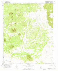
Editions of this 1967 Cerro Brillante Map
2 editions found
Other maps of this area

1954 · Saint Johns
USGS Topo · 1:250,000

1957 · Saint Johns
USGS Topo · 1:250,000

1958 · Saint Johns
USGS Topo · 1:250,000

1962 · Saint Johns
USGS Topo · 1:250,000
1967 · Ice Caves SE
USGS Topo · 1:24,000
1967 · Cerro Hueco
USGS Topo · 1:24,000
1967 · Goat Hill
USGS Topo · 1:24,000

1967 · Cerro Alto
USGS Topo · 1:24,000
1967 · York Ranch
USGS Topo · 1:24,000
1967 · Ice Caves
USGS Topo · 1:24,000