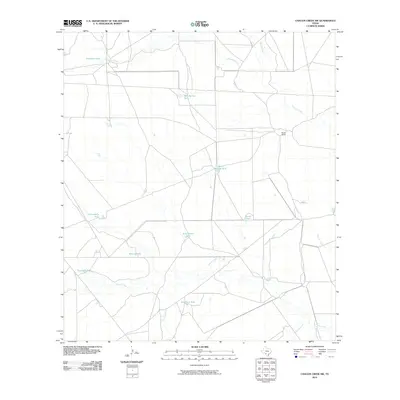
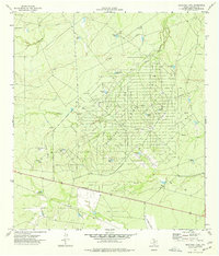
2010 Map of Chacon Creek SW
USGS Topo · Published 2010About this map
Chacon Creek and its many intermittent tributaries define this ranching landscape in Maverick County during the early twenty-first century. The map reveals a sophisticated network of water management features, critical for livestock in this semi-arid region, including Toro Santos Tank, Bean Salinas Tank, and Equirada Tank. These earthen stock tanks are dispersed across a terrain marked by named drainages like Picosa Creek and Spurler Creek. The primary human footprint is found at Burke Ranch, which sits amidst a web of rural roads. In the northern reaches of the quadrangle, Chilipitin Lake provides a notable natural water body along the course of Chilipitin Creek, illustrating the natural drainage patterns that have historically shaped land use and ranch boundaries in this part of South Texas.
Find a feature on this map
16 named features on this map. Tap any name to fly to it.
Don’t see what you’re looking for? This feature index may not catch every label — zoom into the map to look around manually.
Map Details
Editions of this 2010 Chacon Creek SW Map
This is the sole edition of this map. No revisions or reprints were ever made.
Other maps of this area

1940 · Cometa
USGS Topo · 1:62,500

1940 · Eagle Pass
USGS Topo · 1:62,500

1940 · Paloma
USGS Topo · 1:62,500

1940 · Chacon Creek
USGS Topo · 1:62,500

1958 · Eagle Pass
USGS Topo · 1:250,000

1965 · Eagle Pass
USGS Topo · 1:250,000
1974 · Cometa
USGS Topo · 1:24,000
1974 · Indian Tank
USGS Topo · 1:24,000
1974 · Trosado Tank
USGS Topo · 1:24,000
1974 · Sacatosa Tank
USGS Topo · 1:24,000