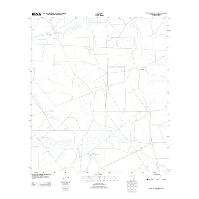
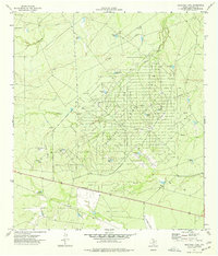
2012 Map of Chacon Creek SW
USGS Topo · Published 2012About this map
Arid grazing lands and seasonal drainages define this portion of Maverick County, as documented by the U.S. Geological Survey in 2012. The landscape is dominated by an extensive network of man-made water catchments, such as Toro Santos Tank, Bean Salinas Tank, and Pinto Ballo Tank, which support livestock in a region where natural permanent water is scarce. Chilipitin Lake and its associated Chilipitin Cr are primary drainage features in the north, while Picosa Cr and Chacon Cr cross the central and eastern sections. The ranching heritage of the area is anchored by the Burke Ranch, reflecting a long-standing settlement pattern based on large landholdings rather than dense township development. This survey provides a clear view of the complex hydrology and ranching infrastructure used to navigate the dry South Texas environment.
Find a feature on this map
16 named features on this map. Tap any name to fly to it.
Don’t see what you’re looking for? This feature index may not catch every label — zoom into the map to look around manually.
Map Details
Editions of this 2012 Chacon Creek SW Map
This is the sole edition of this map. No revisions or reprints were ever made.
Other maps of this area

1940 · Cometa
USGS Topo · 1:62,500

1940 · Eagle Pass
USGS Topo · 1:62,500

1940 · Paloma
USGS Topo · 1:62,500

1940 · Chacon Creek
USGS Topo · 1:62,500

1958 · Eagle Pass
USGS Topo · 1:250,000

1965 · Eagle Pass
USGS Topo · 1:250,000
1974 · Cometa
USGS Topo · 1:24,000
1974 · Indian Tank
USGS Topo · 1:24,000
1974 · Trosado Tank
USGS Topo · 1:24,000
1974 · Sacatosa Tank
USGS Topo · 1:24,000