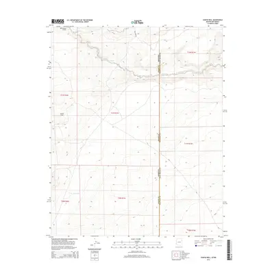
2014 Map of Chafin Well
USGS Topo · Published 2014About this map
Whitewater Arroyo meanders through this high-desert landscape, cutting a path across the border of Apache and McKinley counties. This remote section of the Arizona and New Mexico state line is characterized by the complex drainage patterns of Tolapai Draw and the isolated water source at Good Luck Spring. The map documents a sparse network of rural routes including Jones Ranch Rd and various Bureau of Indian Affairs roads that service the high plateaus.
Find a feature on this map
17 named features on this map. Tap any name to fly to it.
Don’t see what you’re looking for? This feature index may not catch every label — zoom into the map to look around manually.
Map Details
Editions of this 2014 Chafin Well Map
This is the sole edition of this map. No revisions or reprints were ever made.
Other maps of this area

1886 · Wingate
USGS Topo · 1:250,000

1886 · Fort Defiance
USGS Topo · 1:250,000

1892 · Fort Defiance
USGS Topo · 1:250,000

1892 · Wingate
USGS Topo · 1:250,000

1954 · Gallup
USGS Topo · 1:250,000

1958 · Gallup
USGS Topo · 1:250,000

1959 · Gallup
USGS Topo · 1:250,000

1962 · Gallup
USGS Topo · 1:250,000

1963 · Jones Ranch School
USGS Topo · 1:24,000

1967 · Gallup
USGS Topo · 1:250,000