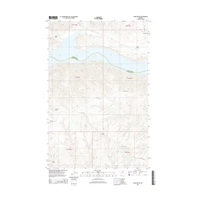
2014 Map of Chain Buttes
USGS Topo · Published 2014About this map
Fort Peck Lake dominates the northern reaches of this landscape, where the waters of the Missouri River are held within the winding coulees of central Montana. This terrain is defined by its drainage patterns and historical routes, situated along the border of Phillips County and Petroleum County. Significant landforms like the Chain Buttes rise above the complex network of seasonal creeks including Soda Cr and Hawley Cr. The map preserves the alignment of the Musselshell Trl and the Alex Camp Trl, which navigate the elevation changes between the high buttes and the reservoir. Remote water management is evident at the Headman-Field Reservoir, while named coulees like Garden Coulee and Carpenter Coulee indicate the deeply eroded character of this rangeland environment.
Find a feature on this map
21 named features on this map. Tap any name to fly to it.
Don’t see what you’re looking for? This feature index may not catch every label — zoom into the map to look around manually.
Map Details
Editions of this 2014 Chain Buttes Map
This is the sole edition of this map. No revisions or reprints were ever made.
Other maps of this area

1954 · Jordan
USGS Topo · 1:250,000

1954 · Lewistown
USGS Topo · 1:250,000

1956 · Jordan
USGS Topo · 1:250,000

1958 · Jordan
USGS Topo · 1:250,000

1959 · Lewistown
USGS Topo · 1:250,000

1964 · Jordan
USGS Topo · 1:250,000

1965 · Karsten Coulee
USGS Topo · 1:24,000

1965 · Dry Coulee
USGS Topo · 1:24,000

1965 · Germaine Coulee West
USGS Topo · 1:24,000

1965 · Chain Buttes
USGS Topo · 1:24,000