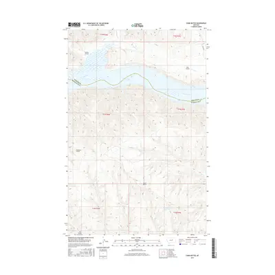
2017 Map of Chain Buttes
USGS Topo · Published 2017About this map
Fort Peck Lake and the Missouri River dominate the northern half of this landscape, forming a natural boundary between Phillips and Petroleum counties. The terrain is characterized by a complex network of dry washes and drainage patterns, including Garden Coulee, Dam Coulee, and Carpenter Coulee, which cut through the high plains toward the river valley. To the south, the namesake Chain Buttes rise as prominent geological landmarks, overlooking a remote stretch of eastern Montana where water management is critical, as evidenced by the Headman Field Reservoir. Minor drainages like Beauchamp Cr, Hawley Cr, and Soda Cr further define the local topography, providing a detailed look at the hydrology of the Missouri River breaks before the land transitions toward Midale Rd on the eastern edge.
Find a feature on this map
19 named features on this map. Tap any name to fly to it.
Don’t see what you’re looking for? This feature index may not catch every label — zoom into the map to look around manually.
Map Details
Editions of this 2017 Chain Buttes Map
This is the sole edition of this map. No revisions or reprints were ever made.
Other maps of this area

1954 · Jordan
USGS Topo · 1:250,000

1954 · Lewistown
USGS Topo · 1:250,000

1956 · Jordan
USGS Topo · 1:250,000

1958 · Jordan
USGS Topo · 1:250,000

1959 · Lewistown
USGS Topo · 1:250,000

1964 · Jordan
USGS Topo · 1:250,000

1965 · Karsten Coulee
USGS Topo · 1:24,000

1965 · Dry Coulee
USGS Topo · 1:24,000

1965 · Germaine Coulee West
USGS Topo · 1:24,000

1965 · Chain Buttes
USGS Topo · 1:24,000