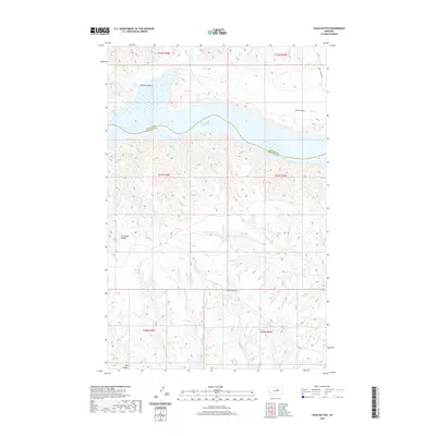
2020 Map of Chain Buttes
USGS Topo · Published 2020About this map
Fort Peck Lake dominates the northern portion of this landscape, its expansive waters following the winding course of the Missouri River valley. The boundary between Phillips Co and Petroleum Co cuts directly through these waters, marking a jurisdictional divide in this remote central Montana terrain. To the south, the land rises into the distinctive formation of the Chain Buttes, which serve as a high point between various drainage systems.
Find a feature on this map
17 named features on this map. Tap any name to fly to it.
Don’t see what you’re looking for? This feature index may not catch every label — zoom into the map to look around manually.
Map Details
Editions of this 2020 Chain Buttes Map
This is the sole edition of this map. No revisions or reprints were ever made.
Other maps of this area

1954 · Jordan
USGS Topo · 1:250,000

1954 · Lewistown
USGS Topo · 1:250,000

1956 · Jordan
USGS Topo · 1:250,000

1958 · Jordan
USGS Topo · 1:250,000

1959 · Lewistown
USGS Topo · 1:250,000

1964 · Jordan
USGS Topo · 1:250,000

1965 · Karsten Coulee
USGS Topo · 1:24,000

1965 · Dry Coulee
USGS Topo · 1:24,000

1965 · Germaine Coulee West
USGS Topo · 1:24,000

1965 · Chain Buttes
USGS Topo · 1:24,000