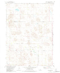
1981 Map of Chain Lake
USGS Topo · Published 1982About this map
The boundary between Holt and Garfield Counties runs through this section of the Nebraska Sandhills, a landscape defined by its distinctive hydrogeology and ranching history. The prevalence of Flowing Wells and isolated water bodies like Willow Lake and Sunfish Lake indicates the region's reliance on the high water table of the Ogallala Aquifer. Scattered ranching operations, including the Ballagh Ranch and Lowery Ranch, represent the primary human imprint on this undulating terrain.
Find a feature on this map
16 named features on this map. Tap any name to fly to it.
Don’t see what you’re looking for? This feature index may not catch every label — zoom into the map to look around manually.
Map Details
Editions of this 1981 Chain Lake Map
2 editions found
Other maps of this area

1952 · Burwell NE
USGS Topo · 1:24,000

1954 · Gables NW
USGS Topo · 1:24,000

1954 · Gables
USGS Topo · 1:24,000

1955 · Broken Bow
USGS Topo · 1:250,000

1955 · O'Neill
USGS Topo · 1:250,000

1956 · Broken Bow
USGS Topo · 1:250,000

1959 · O'Neill
USGS Topo · 1:250,000

1969 · O'Neill
USGS Topo · 1:250,000
1981 · Abbott Ranch
USGS Topo · 1:24,000

1981 · Swan Lake
USGS Topo · 1:24,000