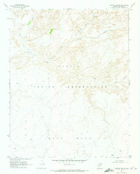
1970 Map of Chaiyahi Rim SW
USGS Topo · Published 1973About this map
The Navajo Indian Reservation dominates this 1970s landscape, where the high elevation of Gray Mesa meets a complex drainage network. The terrain is defined by the Chaiyahi Rim and deep incisions from Navajo Creek and its tributaries, including Chaiyahi Creek and Long Creek. Evidence of human movement through this remote high-desert environment is captured by the Navajo Trail and various stretches of Jeep Trail, indicating traditional routes and modern access points used for land management. Several unnamed springs and a strategically placed Water Tank highlight the critical nature of water resources in this arid Coconino County region. This survey provides a precise topographic record of the canyon systems before major modern development, preserving the nomenclature of localized landforms.
Find a feature on this map
11 named features on this map. Tap any name to fly to it.
Don’t see what you’re looking for? This feature index may not catch every label — zoom into the map to look around manually.
Map Details
Editions of this 1970 Chaiyahi Rim SW Map
This is the sole edition of this map. No revisions or reprints were ever made.
Other maps of this area

1883 · Marsh Pass
USGS Topo · 1:250,000

1886 · Echo Cliffs
USGS Topo · 1:250,000

1891 · Echo Cliffs
USGS Topo · 1:250,000

1892 · Marsh Pass
USGS Topo · 1:250,000

1954 · Navajo Creek
USGS Topo · 1:62,500

1956 · Marble Canyon
USGS Topo · 1:250,000

1959 · Marble Canyon
USGS Topo · 1:250,000

1961 · Marble Canyon
USGS Topo · 1:250,000
1970 · Two Red Mesas
USGS Topo · 1:24,000
1970 · Inscription House Ruin
USGS Topo · 1:24,000