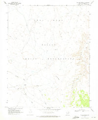
1970 Map of Two Red Mesas
USGS Topo · Published 1973About this map
The Navajo Indian Reservation landscape is defined by the significant presence of archaeological and geological landmarks in this 1970 survey. High terrain features such as Gray Mesa and the eponymous Two Red Mesas dominate the northern and central sections, while the drainage network includes Starting Water Wash and Square Butte Wash. Of particular historical interest are the Cliff Dwellings and a singular Cliff Dwelling located along the steep slopes of Potato Canyon, indicating the long-standing human connection to these sandstone formations. Settlement and ranching evidence is sparse but specific, noted by the presence of Bennett Corral and Bennett Spring in the southwestern quadrant. These markers, along with various scattered Spring and Water Tank labels, underscore the critical importance of water management in this arid Coconino County environment.
Find a feature on this map
13 named features on this map. Tap any name to fly to it.
Don’t see what you’re looking for? This feature index may not catch every label — zoom into the map to look around manually.
Map Details
Editions of this 1970 Two Red Mesas Map
This is the sole edition of this map. No revisions or reprints were ever made.
Other maps of this area

1883 · Marsh Pass
USGS Topo · 1:250,000

1886 · Echo Cliffs
USGS Topo · 1:250,000

1891 · Echo Cliffs
USGS Topo · 1:250,000

1892 · Marsh Pass
USGS Topo · 1:250,000

1954 · Navajo Creek
USGS Topo · 1:62,500

1956 · Marble Canyon
USGS Topo · 1:250,000

1959 · Marble Canyon
USGS Topo · 1:250,000

1961 · Marble Canyon
USGS Topo · 1:250,000

1970 · Square Butte
USGS Topo · 1:24,000

1970 · Whirlwind Rock
USGS Topo · 1:24,000