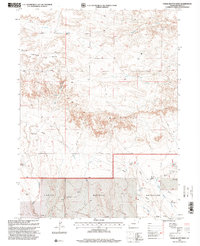
1997 Map of Chalk Bluffs West
USGS Topo · Published 2000About this map
Chalk Bluffs and Simpson Mesa define this high plains landscape in northern Colorado, captured here during the late 1990s. This land-use study, revised by the U.S. Department of Agriculture Forest Service, highlights the essential infrastructure of arid rangelands. The southern portion of the sheet is dominated by the Pawnee National Grassland, where a network of water sources supports the livestock economy. The map documents numerous named water points including the North Owl Windmill, East Simpson Well, and the Mc Cormick Windmill. These features, along with several tanks and pipelines, illustrate the human adaptation to the dry environment of Weld County. Drainages like Simpson Creek and Geary Creek cut through the mesa and bluff formations, while the presence of the Eagle Windmill and Prange Windmill suggests a long history of localized ranching and family-named landmarks.
Find a feature on this map
23 named features on this map. Tap any name to fly to it.
Don’t see what you’re looking for? This feature index may not catch every label — zoom into the map to look around manually.
Map Details
Editions of this 1997 Chalk Bluffs West Map
This is the sole edition of this map. No revisions or reprints were ever made.
Other maps of this area

1908 · Eaton
USGS Topo · 1:125,000

1910 · Eaton
USGS Topo · 1:125,000

1911 · Cheyenne
USGS Topo · 1:125,000

1914 · Cheyenne
USGS Topo · 1:125,000

1950 · Cheyenne
USGS Topo · 1:62,500

1954 · Cheyenne
USGS Topo · 1:250,000

1954 · Greeley
USGS Topo · 1:250,000

1957 · Greeley
USGS Topo · 1:250,000

1958 · Cheyenne
USGS Topo · 1:250,000

1958 · Greeley
USGS Topo · 1:250,000