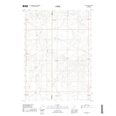
2017 Map of Chalk Hills
USGS Topo · Published 2017About this map
Little Medicine Bow River and its tributary, the S Fork Little Medicine Bow River, define the hydrology of this high-elevation landscape on the border of Carbon and Albany counties. The topography is dominated by the Chalk Hills and various drainage features such as Chalk Draw and Slate Draw. This region is characterized by a sparse network of unpaved transit routes, including Little Medicine Rd, Chalk Hills Rd, and Holiday Rd, which provide access to the open range and water resources like Three Mile Reservoir. The lack of concentrated settlements or industrial markers suggests a dedicated focus on livestock grazing and water management in this high-plains environment, where seasonal watercourses like Threemile Cr carve through the sedimentary terrain.
Find a feature on this map
23 named features on this map. Tap any name to fly to it.
Don’t see what you’re looking for? This feature index may not catch every label — zoom into the map to look around manually.
Map Details
Editions of this 2017 Chalk Hills Map
This is the sole edition of this map. No revisions or reprints were ever made.
Other maps of this area

1954 · Torrington
USGS Topo · 1:250,000

1955 · Casper
USGS Topo · 1:250,000

1958 · Casper
USGS Topo · 1:250,000

1958 · Torrington
USGS Topo · 1:250,000

1959 · Moss Agate Reservoir
USGS Topo · 1:24,000

1959 · Squaw Spring
USGS Topo · 1:24,000

1959 · Chalk Hills
USGS Topo · 1:24,000

1959 · Bates Creek Reservoir
USGS Topo · 1:24,000
1961 · Big Charlie Lakes
USGS Topo · 1:24,000
1961 · Walker Draw NW
USGS Topo · 1:24,000