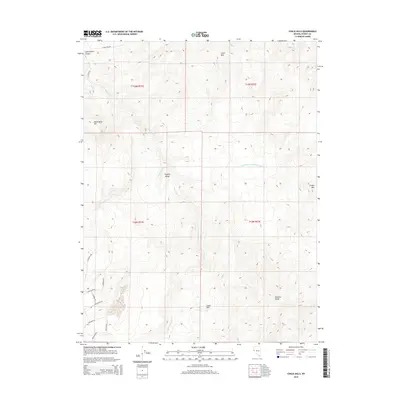
2014 Map of Chalk Hills
USGS Topo · Published 2014About this map
The Virginia Range dominates this landscape in Storey County, where complex terrain and water management systems define the high desert character of northwestern Nevada. The map highlights the engineered irrigation of the Lagomarsino Murphy Ditch alongside natural drainages like Long Valley Cr and Lousetown Cr. These waterways cut through a series of named peaks and ridges, including Clark Mtn to the north and Cinder Mtn to the east. Modern access is recorded through a network of roads such as Northstar Rd and Cartwright Rd, which navigate the slopes between the Chalk Hills and the Flowery Range. The presence of Lagomarsino Canyon in the northwest corner suggests a long history of natural erosion and seasonal runoff patterns essential to the local environment.
Find a feature on this map
24 named features on this map. Tap any name to fly to it.
Don’t see what you’re looking for? This feature index may not catch every label — zoom into the map to look around manually.
Map Details
Editions of this 2014 Chalk Hills Map
This is the sole edition of this map. No revisions or reprints were ever made.
Other maps of this area

1890 · Wadsworth
USGS Topo · 1:125,000

1891 · Carson
USGS Topo · 1:125,000

1891 · Wabuska
USGS Topo · 1:125,000

1891 · Reno
USGS Topo · 1:125,000

1892 · Wadsworth
USGS Topo · 1:125,000

1893 · Carson
USGS Topo · 1:125,000

1893 · Reno
USGS Topo · 1:125,000

1894 · Wadsworth
USGS Topo · 1:125,000

1894 · Wabuska
USGS Topo · 1:125,000

1950 · Virginia City
USGS Topo · 1:62,500