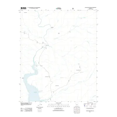
2011 Map of Chalk Mountain
USGS Topo · Published 2011About this map
The Verde River carves through this arid landscape, feeding into the northern reaches of the Horseshoe Reservoir. This 2011 survey captures a remote region of Maricopa County defined by its cattle ranching history and dramatic hydrological features. The presence of the H K Ranch and JS Ranch underscores the area's agricultural ties, while the Sheep Bridge marks a vital historical crossing point for livestock over the river.
Find a feature on this map
25 named features on this map. Tap any name to fly to it.
Don’t see what you’re looking for? This feature index may not catch every label — zoom into the map to look around manually.
Map Details
Editions of this 2011 Chalk Mountain Map
This is the sole edition of this map. No revisions or reprints were ever made.
Other maps of this area

1887 · Verde
USGS Topo · 1:250,000

1892 · Verde
USGS Topo · 1:250,000

1929 · Turret Peak
USGS Topo · 1:125,000

1930 · Cave Creek
USGS Topo · 1:125,000

1933 · Turret Peak
USGS Topo · 1:125,000

1939 · Cave Creek
USGS Topo · 1:125,000

1954 · Holbrook
USGS Topo · 1:250,000

1954 · Mesa
USGS Topo · 1:250,000

1957 · Mesa
USGS Topo · 1:250,000

1957 · Holbrook
USGS Topo · 1:250,000