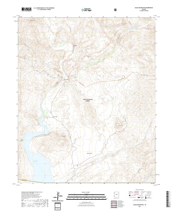
2021 Map of Chalk Mountain
USGS Topo · Published 2021About this map
The Verde River carves a deep corridor through this portion of the Tonto National Forest, creating a landscape defined by dramatic elevation changes and remote water sources. The Sheep Bridge serves as a critical crossing point near the confluence of Tangle Cr and the main river channel, anchoring a network of historic pathways including the Verde River Trl and Dutchman Grave Trl. To the south, the terrain opens into the northern reaches of the Horseshoe Reservoir, where the seasonal fluctuations of the water meet the desert flats.
Find a feature on this map
31 named features on this map. Tap any name to fly to it.
Don’t see what you’re looking for? This feature index may not catch every label — zoom into the map to look around manually.
Map Details
Editions of this 2021 Chalk Mountain Map
This is the sole edition of this map. No revisions or reprints were ever made.
Other maps of this area

1887 · Verde
USGS Topo · 1:250,000

1892 · Verde
USGS Topo · 1:250,000

1929 · Turret Peak
USGS Topo · 1:125,000

1930 · Cave Creek
USGS Topo · 1:125,000

1933 · Turret Peak
USGS Topo · 1:125,000

1939 · Cave Creek
USGS Topo · 1:125,000

1954 · Holbrook
USGS Topo · 1:250,000

1954 · Mesa
USGS Topo · 1:250,000

1957 · Mesa
USGS Topo · 1:250,000

1957 · Holbrook
USGS Topo · 1:250,000