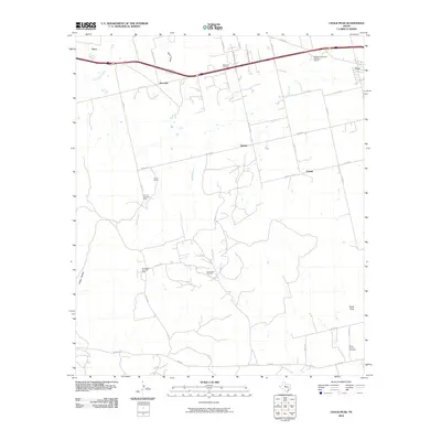
2010 Map of Chalk Peak
USGS Topo · Published 2010About this map
White Church Cemetery and the prominent landmark of Chalk Peak define the landscape south of the West Texas settlement of Trent. This area is shaped by a long history of energy production and transportation, characterized by the White Flat Oil Field and the Northwest Dora Oil Field that dot the plains. The presence of the Grimes Gasoline Plant and the smaller North Dora Oil Field illustrate the industrial footprint that exists alongside ranching operations like the Adrian Ranch.
Find a feature on this map
35 named features on this map. Tap any name to fly to it.
Don’t see what you’re looking for? This feature index may not catch every label — zoom into the map to look around manually.
Map Details
Editions of this 2010 Chalk Peak Map
This is the sole edition of this map. No revisions or reprints were ever made.
Other maps of this area

1893 · Roby
USGS Topo · 1:125,000

1893 · Sweetwater
USGS Topo · 1:125,000

1954 · Big Spring
USGS Topo · 1:250,000

1957 · Merkel
USGS Topo · 1:62,500

1957 · Noodle
USGS Topo · 1:62,500

1958 · Big Spring
USGS Topo · 1:250,000

1969 · Eskota
USGS Topo · 1:24,000

1969 · Holder Creek
USGS Topo · 1:24,000
1969 · Lake Sweetwater
USGS Topo · 1:24,000
1984 · Merkel West
USGS Topo · 1:24,000