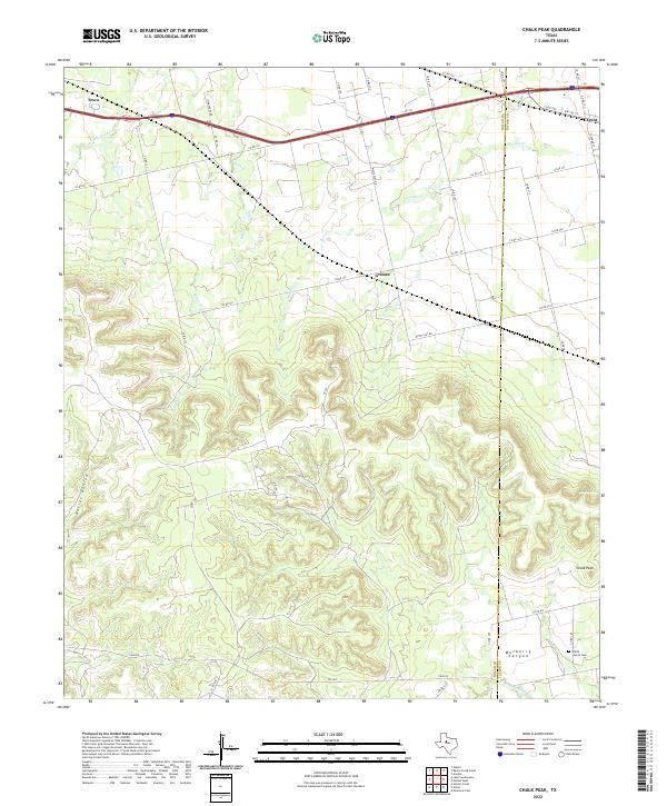
2022 Map of Chalk Peak
USGS Topo · Published 2022About this map
Mulberry Canyon and the high point of Chalk Peak dominate this Texas landscape along the border of Nolan and Taylor counties. The terrain transitions from the rugged breaks of Oaties Hollow in the west to the more level drainage basins of Noodle Cr and Stink Cr in the north. This geography has historically dictated the settlement pattern, with the small community of Grimes and the southern edge of Trent positioned near the rail-aligned corridor of Interstate 20.
Find a feature on this map
45 named features on this map. Tap any name to fly to it.
Don’t see what you’re looking for? This feature index may not catch every label — zoom into the map to look around manually.
Map Details
Editions of this 2022 Chalk Peak Map
This is the sole edition of this map. No revisions or reprints were ever made.
Other maps of this area

1893 · Roby
USGS Topo · 1:125,000

1893 · Sweetwater
USGS Topo · 1:125,000

1954 · Big Spring
USGS Topo · 1:250,000

1957 · Merkel
USGS Topo · 1:62,500

1957 · Noodle
USGS Topo · 1:62,500

1958 · Big Spring
USGS Topo · 1:250,000

1969 · Eskota
USGS Topo · 1:24,000

1969 · Holder Creek
USGS Topo · 1:24,000
1969 · Lake Sweetwater
USGS Topo · 1:24,000
1984 · Merkel West
USGS Topo · 1:24,000