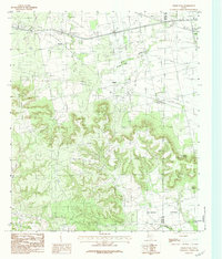
1984 Map of Chalk Peak
USGS Topo · Published 1984About this map
Trent and several small rural settlements punctuate the rolling landscape of West Texas along the border of Nolan and Taylor counties. The terrain is defined by the prominent Chalk Peak and Gainey Point, with numerous drainages like Stink Creek and Noodle Creek carving through the countryside. This 1984 edition serves as a detailed record of local genealogy and infrastructure, particularly centered around the Mulberry Canyon Cem and dispersed agricultural sites like Herndon, Grimes, and Toland. The presence of Sand Spring and the headwaters of Weaver Springs Creek suggest the vital role of water management in this cattle and oil-producing region, providing researchers with a clear look at the area's development before late-twentieth-century changes.
Find a feature on this map
16 named features on this map. Tap any name to fly to it.
Don’t see what you’re looking for? This feature index may not catch every label — zoom into the map to look around manually.
Map Details
Editions of this 1984 Chalk Peak Map
This is the sole edition of this map. No revisions or reprints were ever made.
Other maps of this area

1893 · Roby
USGS Topo · 1:125,000

1893 · Sweetwater
USGS Topo · 1:125,000

1954 · Big Spring
USGS Topo · 1:250,000

1957 · Merkel
USGS Topo · 1:62,500

1957 · Noodle
USGS Topo · 1:62,500

1958 · Big Spring
USGS Topo · 1:250,000

1969 · Eskota
USGS Topo · 1:24,000

1969 · Holder Creek
USGS Topo · 1:24,000
1969 · Lake Sweetwater
USGS Topo · 1:24,000
1984 · Merkel West
USGS Topo · 1:24,000