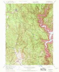
1948 Map of Challenge
USGS Topo · Published 1971About this map
Challenge and the surrounding Sharon Valley are the primary focus of this late 1940s landscape, which underwent significant updates in 1969 to reflect the expansion of the Bullards Bar Reservoir. This survey captures the transition of the Yuba River canyon, where purple photorevision marks indicate the new shoreline at Spillway Elevation 1902. The region’s deep ties to the Gold Country are evident in several extractive sites, including the Mother Lodes Mines, Red Cross Mine, and Horseshoe Mine. A patchwork of family-owned ranching history is preserved through labels like Indiana Ranch, Whitehead Ranch, and the Summit Hill Ranch. Higher elevations within the Plumas National Forest and Tahoe National Forest are monitored from the Pike County Pk Lookout and the Lookout Tower on Oregon Pk.
Find a feature on this map
53 named features on this map. Tap any name to fly to it.
Don’t see what you’re looking for? This feature index may not catch every label — zoom into the map to look around manually.
Map Details
Editions of this 1948 Challenge Map
4 editions found
Other maps of this area

1888 · Smartsville
USGS Topo · 1:125,000

1888 · Bidwell Bar
USGS Topo · 1:125,000

1891 · Bidwell Bar
USGS Topo · 1:125,000

1891 · Smartsville
USGS Topo · 1:125,000

1892 · Smartsville
USGS Topo · 1:125,000

1893 · Bidwell Bar
USGS Topo · 1:125,000

1894 · Smartsville
USGS Topo · 1:125,000

1895 · Bidwell Bar
USGS Topo · 1:125,000

1895 · Smartsville
USGS Topo · 1:125,000

1897 · Bidwell Bar
USGS Topo · 1:125,000