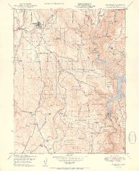
1950 Map of Challenge
USGS Topo · Published 1950About this map
The Yuba River canyon and the southern reaches of the Plumas National Forest define this landscape during the mid-century era. The map details a period when the timber and mining industries remained visible across the terrain, evidenced by a Sawmill near Little Oregon Creek and several legacy extraction sites like the Horseshoe Mine and the Mother Lode Mine (Inactive). The settlement at Challenge serves as a local hub, featuring a Ranger Sta and proximity to the Sharon Valley.
Find a feature on this map
53 named features on this map. Tap any name to fly to it.
Don’t see what you’re looking for? This feature index may not catch every label — zoom into the map to look around manually.
Map Details
Editions of this 1950 Challenge Map
3 editions found
Other maps of this area

1888 · Smartsville
USGS Topo · 1:125,000

1888 · Bidwell Bar
USGS Topo · 1:125,000

1891 · Bidwell Bar
USGS Topo · 1:125,000

1891 · Smartsville
USGS Topo · 1:125,000

1892 · Smartsville
USGS Topo · 1:125,000

1893 · Bidwell Bar
USGS Topo · 1:125,000

1894 · Smartsville
USGS Topo · 1:125,000

1895 · Bidwell Bar
USGS Topo · 1:125,000

1895 · Smartsville
USGS Topo · 1:125,000

1897 · Bidwell Bar
USGS Topo · 1:125,000