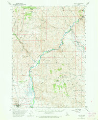
1956 Map of Challis
USGS Topo · Published 1970About this map
The Salmon River carves a deep path through Custer County, Idaho, in this mid-century survey, flanked by the Pahsimeroi Mountains and the Salmon River Mountains. The town of Challis sits at the foot of these ranges, serving as a hub near the Challis Airfield and the irrigation network of Garden Creek. Geothermal activity is a notable characteristic of the landscape, marked by the Beardsley Hot Springs south of town and a Hot Spring further north in Cronks Canyon.
Find a feature on this map
48 named features on this map. Tap any name to fly to it.
Don’t see what you’re looking for? This feature index may not catch every label — zoom into the map to look around manually.
Map Details
Editions of this 1956 Challis Map
2 editions found
Other maps of this area

1929 · Bayhorse
USGS Topo · 1:125,000

1935 · Borah Peak
USGS Topo · 1:125,000

1938 · Borah Peak
USGS Topo · 1:125,000

1955 · Dubois
USGS Topo · 1:250,000

1956 · Doublespring
USGS Topo · 1:62,500

1956 · May
USGS Topo · 1:62,500

1956 · Challis
USGS Topo · 1:62,500

1956 · Twin Peaks
USGS Topo · 1:62,500

1957 · Challis
USGS Topo · 1:250,000

1958 · Dubois
USGS Topo · 1:250,000