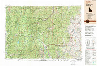
1989 Map of Challis
USGS Topo · Published 1989About this map
The Salmon River Mountains and the winding course of the Salmon River dominate this late-century landscape, illustrating a region defined by its massive protected wilderness areas. Central Idaho in the 1980s was characterized by a long-standing mining economy alongside an expanding recreation sector. The map documents significant mining operations like the Yellow Pine Mine and the Sunnyside Mine near Stibnite, contrasting with the established boundaries of the Frank Church-River of No Return Wilderness. Smaller settlements such as Sunbeam, Clayton, and Stanley serve as gateways to the high-elevation terrain of the Sawtooth Range. The presence of several historic mines, including the Lucky Boy Mine and Silver Bell Mine, provides a detailed record of the extractive history that initially drew settlers to the remote canyons of the Challis National Forest.
Find a feature on this map
47 named features on this map. Tap any name to fly to it.
Don’t see what you’re looking for? This feature index may not catch every label — zoom into the map to look around manually.
Map Details
Editions of this 1989 Challis Map
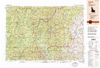
2 editions found
Other maps of this area

1891 · Bear Valley
USGS Topo · 1:125,000

1892 · Boise
USGS Topo · 1:125,000

1893 · Bear Valley
USGS Topo · 1:125,000

1894 · Squaw Creek
USGS Topo · 1:125,000

1894 · Idaho Basin
USGS Topo · 1:125,000

1894 · Rocky Bar
USGS Topo · 1:125,000

1895 · Hailey
USGS Topo · 1:125,000

1897 · Boise
USGS Topo · 1:125,000

1897 · Hailey
USGS Topo · 1:125,000

1900 · Sawtooth
USGS Topo · 1:125,000