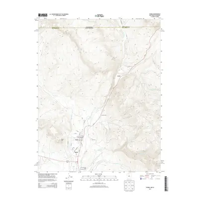
2013 Map of Chama
USGS Topo · Published 2013About this map
Chama sits at the heart of this high-elevation landscape, where the Rio Chama and Rio Chamita converge near the Colorado-New Mexico border. The town's grid is clearly defined by local streets like Pinon Dr and Maple Ave, reflecting its role as a regional hub. A significant cultural and transportation landmark, the Cumbres and Toltec Scenic Railroad winds through the valley, following the path of NM-17. This narrow-gauge line represents a preserved piece of Western rail history that remains central to the area's identity.
Find a feature on this map
34 named features on this map. Tap any name to fly to it.
Don’t see what you’re looking for? This feature index may not catch every label — zoom into the map to look around manually.
Map Details
Editions of this 2013 Chama Map
This is the sole edition of this map. No revisions or reprints were ever made.
Other maps of this area

1913 · Summitville
USGS Topo · 1:125,000

1915 · Summitville
USGS Topo · 1:125,000

1918 · Tusas
USGS Topo · 1:125,000

1922 · Conejos
USGS Topo · 1:125,000

1945 · Durango
USGS Topo · 1:250,000

1953 · Durango
USGS Topo · 1:250,000

1954 · Durango
USGS Topo · 1:250,000

1954 · Aztec
USGS Topo · 1:250,000

1955 · Chama
USGS Topo · 1:62,500

1955 · Brazos Peak
USGS Topo · 1:62,500