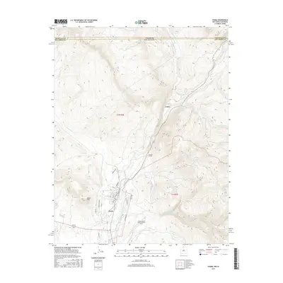
2017 Map of Chama
USGS Topo · Published 2017About this map
The village of Chama sits at the confluence of the Rio Chama and Rio Chamita, serving as a focal point for this northern New Mexico landscape near the Colorado border. The map illustrates a community defined by its topography and water rights, featuring irrigation works like the Meb Ditch and numerous mountain streams including Wolf Cr and Little Willow Cr. To the north, the settlement of Lobato occupies a narrow valley floor, while the surrounding high ground is marked by prominent landmarks such as Rabbit Peak. The area's ranching and aviation character is evident through the inclusion of the Chama Land & Cattle Company Airport and Eastside Airport. Genealogists and local historians will find the exact location of the Chama Cem and the residential street grid, including Terrace Ave and Maple Ave, providing a clear view of the town's modern footprint and historical orientation within Rio Arriba County.
Find a feature on this map
34 named features on this map. Tap any name to fly to it.
Don’t see what you’re looking for? This feature index may not catch every label — zoom into the map to look around manually.
Map Details
Editions of this 2017 Chama Map
This is the sole edition of this map. No revisions or reprints were ever made.
Other maps of this area

1913 · Summitville
USGS Topo · 1:125,000

1915 · Summitville
USGS Topo · 1:125,000

1918 · Tusas
USGS Topo · 1:125,000

1922 · Conejos
USGS Topo · 1:125,000

1945 · Durango
USGS Topo · 1:250,000

1953 · Durango
USGS Topo · 1:250,000

1954 · Durango
USGS Topo · 1:250,000

1954 · Aztec
USGS Topo · 1:250,000

1955 · Chama
USGS Topo · 1:62,500

1955 · Brazos Peak
USGS Topo · 1:62,500