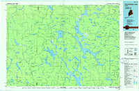
1986 Map of Chamberlain Lake
USGS Topo · Published 1986About this map
The Allagash Wilderness Waterway serves as the central artery of this Maine backcountry landscape, documenting a region defined by its vast water network and logging history. The map illustrates a transitional era where traditional timber transport infrastructure, such as the Tramway between Eagle Lake and Chamberlain Lake, remained a visible landmark of the industrial past within a protected wilderness. Rare settlements like Churchill Depot and Camp Phoenix mark the few outposts in a territory otherwise organized by the rectangular grid of West of East Line of State (WELS) townships.
Find a feature on this map
180 named features on this map. Tap any name to fly to it.
Don’t see what you’re looking for? This feature index may not catch every label — zoom into the map to look around manually.
Map Details
Editions of this 1986 Chamberlain Lake Map
This is the sole edition of this map. No revisions or reprints were ever made.
Other maps of this area

1927 · Katahdin
USGS Topo · 1:48,000

1930 · Katahdin
USGS Topo · 1:62,500

1931 · Mooseleuk Lake
USGS Topo · 1:48,000

1932 · Umsaskis Lake
USGS Topo · 1:48,000

1932 · Musquacook Lakes
USGS Topo · 1:48,000

1935 · Umsaskis Lake
USGS Topo · 1:62,500

1935 · Musquacook Lakes
USGS Topo · 1:62,500

1935 · Mooseleuk Lake
USGS Topo · 1:62,500

1949 · Jackman
USGS Topo · 1:250,000

1949 · Katahdin
USGS Topo · 1:62,500