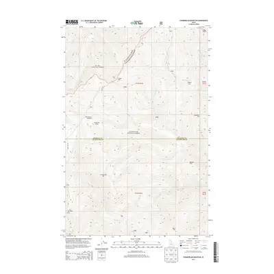
2014 Map of Chamberlain Mountain
USGS Topo · Published 2014About this map
St Joe National Forest and Clearwater National Forest converge at the boundary of Shoshone and Clearwater counties, forming a high-elevation landscape defined by sharp peaks and steep drainages. The topography is dominated by summits like Chamberlain Mtn and Birch Mtn, which overlook a network of seasonal and perennial waters including Chamberlain Creek and Meadow Creek. Human presence is notably sparse, marked primarily by the Klug Cabin in the southern reaches and the winding path of Gospel Hill Rd. This 2014 survey documents the complex watershed where Fall Creek and Dave Ingram Creek feed into larger systems, with landmarks like Chamberlain Meadows and Vanderbilt Hill providing orientation in this roadless interior. The map reflects a modern era of forest management where recreation and conservation take precedence over the industrial footprints found in lower-lying areas.
Find a feature on this map
32 named features on this map. Tap any name to fly to it.
Don’t see what you’re looking for? This feature index may not catch every label — zoom into the map to look around manually.
Map Details
Editions of this 2014 Chamberlain Mountain Map
This is the sole edition of this map. No revisions or reprints were ever made.
Other maps of this area

1911 · Lolo
USGS Topo · 1:250,000

1913 · Lolo
USGS Topo · 1:250,000

1918 · St Regis
USGS Topo · 1:125,000

1919 · St. Regis
USGS Topo · 1:125,000

1956 · Wallace
USGS Topo · 1:250,000

1956 · Hamilton
USGS Topo · 1:250,000

1957 · Illinois Peak
USGS Topo · 1:62,500

1957 · Simmons Peak
USGS Topo · 1:62,500

1959 · Hamilton
USGS Topo · 1:250,000

1960 · Wallace
USGS Topo · 1:250,000