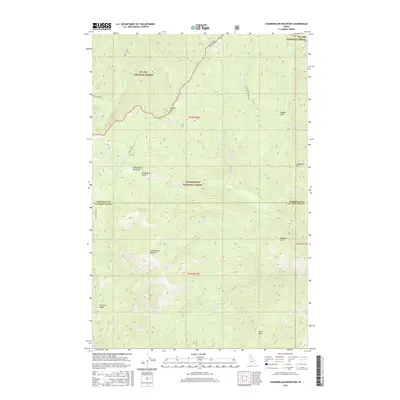
2017 Map of Chamberlain Mountain
USGS Topo · Published 2017About this map
Chamberlain Mountain stands as a central peak in a landscape defined by the intersection of the St Joe National Forest and Clearwater National Forest. This 2017 survey details a high-elevation wilderness divided by the Shoshone and Clearwater county line, where the drainage patterns of Chamberlain Cr and Meadow Cr shape the steep topography. The map illustrates a network of forestry and backcountry routes, including the Bacon Loop and Gospel Hill Rd, providing access to isolated landmarks such as Gospel Hill and Chamberlain Meadows. To the south, the terrain rises toward Pot Mtn Ridge and Birch Mtn, sheltering the secluded Fly Lake. The mapping of these drainages, from Caledonia Cr to the Niagara Gulch, provides a look at the hydrography that sustains this remote section of the Bitterroot range.
Find a feature on this map
31 named features on this map. Tap any name to fly to it.
Don’t see what you’re looking for? This feature index may not catch every label — zoom into the map to look around manually.
Map Details
Editions of this 2017 Chamberlain Mountain Map
This is the sole edition of this map. No revisions or reprints were ever made.
Other maps of this area

1911 · Lolo
USGS Topo · 1:250,000

1913 · Lolo
USGS Topo · 1:250,000

1918 · St Regis
USGS Topo · 1:125,000

1919 · St. Regis
USGS Topo · 1:125,000

1956 · Wallace
USGS Topo · 1:250,000

1956 · Hamilton
USGS Topo · 1:250,000

1957 · Illinois Peak
USGS Topo · 1:62,500

1957 · Simmons Peak
USGS Topo · 1:62,500

1959 · Hamilton
USGS Topo · 1:250,000

1960 · Wallace
USGS Topo · 1:250,000