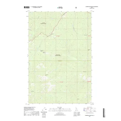
2020 Map of Chamberlain Mountain
USGS Topo · Published 2020About this map
St. Joe National Forest and Clearwater National Forest meet at the boundary of Shoshone and Clearwater counties, defining a landscape of high ridges and deep drainage basins. The divide is anchored by Chamberlain Mtn and Pot Mtn Ridge, with Birch Mtn rising to the southeast. This region is characterized by its network of creeks, including Chamberlain Cr and Meadow Cr, which flow through steep gulches such as Vanderbilt Gulch and Niagara Gulch. The map records a modern forest infrastructure, where Gospel Hill Rd and the Bacon Loop trail provide access to interior points like Gospel Hill and Chamberlain Meadows. To the south, Fly Lake sits below the ridgeline, marking one of the few named bodies of standing water in this drainage-heavy terrain.
Find a feature on this map
33 named features on this map. Tap any name to fly to it.
Don’t see what you’re looking for? This feature index may not catch every label — zoom into the map to look around manually.
Map Details
Editions of this 2020 Chamberlain Mountain Map
This is the sole edition of this map. No revisions or reprints were ever made.
Other maps of this area

1911 · Lolo
USGS Topo · 1:250,000

1913 · Lolo
USGS Topo · 1:250,000

1918 · St Regis
USGS Topo · 1:125,000

1919 · St. Regis
USGS Topo · 1:125,000

1956 · Wallace
USGS Topo · 1:250,000

1956 · Hamilton
USGS Topo · 1:250,000

1957 · Illinois Peak
USGS Topo · 1:62,500

1957 · Simmons Peak
USGS Topo · 1:62,500

1959 · Hamilton
USGS Topo · 1:250,000

1960 · Wallace
USGS Topo · 1:250,000