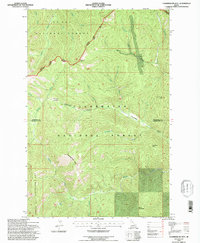
1994 Map of Chamberlain Mtn
USGS Topo · Published 1997About this map
St Joe National Forest and Clearwater National Forest converge at the boundary of Shoshone and Clearwater counties, defining a landscape where forestry and mining interests once intersected. High elevations like Pot Mountain Ridge and Chamberlain Mtn dominate the terrain, with water drainage systems such as Chamberlain Creek and Meadow Creek carving deep into the mountainside. Human activity is evidenced by isolated outposts like Klug Cabin and the seasonal Chamberlain Meadows, while industrial history is represented by the Clearwater Mine located near Niagara Gulch. The northern portion of the map is accessed via the Avery Rd N Fork Rd, which skirts Dump Creek and Bear Creek. This 1990s revision provides a detailed look at the network of Forest Service trails and fire access routes that replaced earlier wagon roads, connecting peaks like Birch Mountain and Gospel Hill.
Find a feature on this map
27 named features on this map. Tap any name to fly to it.
Don’t see what you’re looking for? This feature index may not catch every label — zoom into the map to look around manually.
Map Details
Editions of this 1994 Chamberlain Mtn Map
This is the sole edition of this map. No revisions or reprints were ever made.
Other maps of this area

1911 · Lolo
USGS Topo · 1:250,000

1913 · Lolo
USGS Topo · 1:250,000

1918 · St Regis
USGS Topo · 1:125,000

1919 · St. Regis
USGS Topo · 1:125,000

1956 · Wallace
USGS Topo · 1:250,000

1956 · Hamilton
USGS Topo · 1:250,000

1957 · Illinois Peak
USGS Topo · 1:62,500

1957 · Simmons Peak
USGS Topo · 1:62,500

1959 · Hamilton
USGS Topo · 1:250,000

1960 · Wallace
USGS Topo · 1:250,000