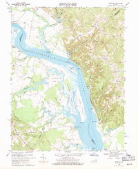
1968 Map of Champlain
USGS Topo · Published 1971About this map
Rappahannock River dominates this late-1960s landscape, serving as the boundary between Essex, Westmoreland, and Richmond Counties. The river's influence on local commerce and geography is evident through numerous historic waterfront points, including Daingerfield Landing, Carters Wharf, and Baird Landing. On the northern bank, the dramatic elevation of Fones Cliffs rises sharply above the water, while the southern side is characterized by extensive wetlands such as Beverly Marsh and Otterburn Marsh.
Find a feature on this map
63 named features on this map. Tap any name to fly to it.
Don’t see what you’re looking for? This feature index may not catch every label — zoom into the map to look around manually.
Map Details
Editions of this 1968 Champlain Map
4 editions found
Other maps of this area

1889 · Fredericksburg
USGS Topo · 1:125,000

1892 · Fredericksburg
USGS Topo · 1:125,000

1892 · Montross
USGS Topo · 1:62,500

1894 · Fredericksburg
USGS Topo · 1:125,000

1895 · Nomini
USGS Topo · 1:125,000

1895 · Montross
USGS Topo · 1:62,500

1898 · Nomini
USGS Topo · 1:125,000

1918 · Tappahannock
USGS Topo · 1:62,500

1918 · Aylett
USGS Topo · 1:62,500

1919 · Tappahannock
USGS Topo · 1:62,500