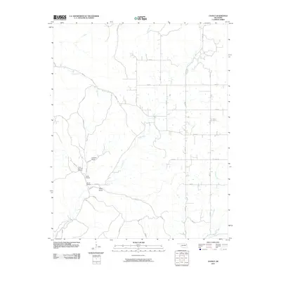
2010 Map of Chance
USGS Topo · Published 2010About this map
Tyner Creek and its many tributaries carve through this Adair County landscape, defining the rural character of the region. The area is marked by a series of named drainages and valleys, including Cow Bog Hollow, Gray Squirrel Hollow, and Murell Hollow, which suggest a long history of local naming conventions tied to the terrain and wildlife. The road network, including Chance Rd and Calhoun Rd, follows a combination of section lines and the natural contours of the hills, providing access to dispersed farmsteads and rural residences.
Find a feature on this map
34 named features on this map. Tap any name to fly to it.
Don’t see what you’re looking for? This feature index may not catch every label — zoom into the map to look around manually.
Map Details
Editions of this 2010 Chance Map
This is the sole edition of this map. No revisions or reprints were ever made.
Other maps of this area

1898 · Tahlequah
USGS Topo · 1:125,000

1899 · Siloam Springs
USGS Topo · 1:125,000

1901 · Tahlequah
USGS Topo · 1:125,000

1903 · Siloam Springs
USGS Topo · 1:125,000

1904 · Siloam Springs
USGS Topo · 1:125,000

1905 · Tahlequah
USGS Topo · 1:125,000

1946 · Fort Smith
USGS Topo · 1:250,000

1954 · Tulsa
USGS Topo · 1:250,000

1958 · Tulsa
USGS Topo · 1:250,000

1963 · Tulsa
USGS Topo · 1:250,000