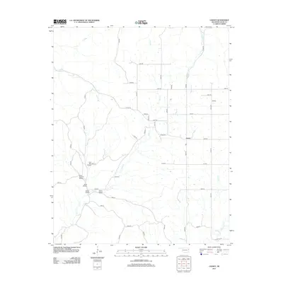
2012 Map of Chance
USGS Topo · Published 2012About this map
Chance serves as the primary focal point of this 2012 survey, situated within a landscape defined by an intricate network of named hollows and creek drainages in Adair County. The topography is deeply etched by features such as Cow Bog Hollow, Gray Squirrel Hollow, and Turkey Hollow, illustrating the complex drainage patterns that feed into Tyner Cr and its tributaries. The map reveals a rural infrastructure reliant on an extensive grid of local routes like Chewey Rd and E0680 Rd, which navigate the various ridges and creek bottoms. Waterways like Jaybird Cr and Peacheater Cr delineate the eastern terrain, while small branches such as Luna Br and Tate Parris Br reach into the higher elevations. This document provides a clear view of the area's modern land division and rural residential patterns.
Find a feature on this map
45 named features on this map. Tap any name to fly to it.
Don’t see what you’re looking for? This feature index may not catch every label — zoom into the map to look around manually.
Map Details
Editions of this 2012 Chance Map
This is the sole edition of this map. No revisions or reprints were ever made.
Other maps of this area

1898 · Tahlequah
USGS Topo · 1:125,000

1899 · Siloam Springs
USGS Topo · 1:125,000

1901 · Tahlequah
USGS Topo · 1:125,000

1903 · Siloam Springs
USGS Topo · 1:125,000

1904 · Siloam Springs
USGS Topo · 1:125,000

1905 · Tahlequah
USGS Topo · 1:125,000

1946 · Fort Smith
USGS Topo · 1:250,000

1954 · Tulsa
USGS Topo · 1:250,000

1958 · Tulsa
USGS Topo · 1:250,000

1963 · Tulsa
USGS Topo · 1:250,000