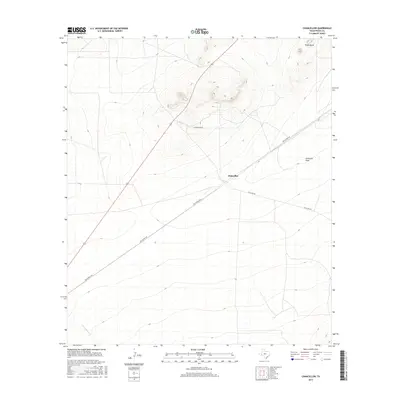
2016 Map of Chancellor
USGS Topo · Published 2016About this map
Chancellor serves as the central focal point of this West Texas landscape, situated at the junction of several key regional routes. The map documents a sparsely populated area of Pecos County where the vast drainage of Acebuche Draw and the course of Burnt House Cr define the movement of water through the arid terrain. Dominating the northern horizon, the distinct peaks of Triple Butte provide a significant visual landmark for travelers and ranchers alike.
Find a feature on this map
7 named features on this map. Tap any name to fly to it.
Don’t see what you’re looking for? This feature index may not catch every label — zoom into the map to look around manually.
Map Details
Editions of this 2016 Chancellor Map
This is the sole edition of this map. No revisions or reprints were ever made.
Other maps of this area

1929 · Hovey
USGS Topo · 1:125,000

1954 · Fort Stockton
USGS Topo · 1:250,000

1958 · Fort Stockton
USGS Topo · 1:250,000

1970 · Belding SW
USGS Topo · 1:24,000

1970 · Deep Well Ranch SE
USGS Topo · 1:24,000
1970 · Belding
USGS Topo · 1:24,000

1973 · Fort Stockton
USGS Topo · 1:250,000
1980 · Chancellor
USGS Topo · 1:24,000
1980 · Cave Mesa NE
USGS Topo · 1:24,000

1980 · Cave Mesa
USGS Topo · 1:24,000