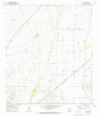
1970 Map of Belding
USGS Topo · Published 1987About this map
The Atchison Topeka And Santa Fe railroad cuts a straight diagonal through this high-desert landscape, anchoring the small settlement of Belding in West Texas. Situated south of Fort Stockton, this area is defined by the ephemeral drainage patterns of Acebuche Draw and Belding Draw, which carve shallow paths through the arid terrain. The map captures a moment of industrial transition, where traditional ranching infrastructure like a Water Tank and numerous fences sits alongside modern extractive footprints, including a scattered network of Wells, Gas Wells, and Gravel Pits. A lone Landing Strip and a prominent Pipeline corridor further emphasize the region's role as a logistical and energy-producing hub during the early 1970s. The dense topographic contours on the western edge reveal the rising elevation of the foothills, providing a stark contrast to the flat, well-dotted plains of the Pecos County interior.
Find a feature on this map
13 named features on this map. Tap any name to fly to it.
Don’t see what you’re looking for? This feature index may not catch every label — zoom into the map to look around manually.
Map Details
Editions of this 1970 Belding Map
This is the sole edition of this map. No revisions or reprints were ever made.
Other maps of this area

1921 · Fort Stockton
USGS Topo · 1:62,500

1923 · Fort Stockton
USGS Topo · 1:62,500

1923 · Sierra Madera
USGS Topo · 1:62,500

1928 · Comanche Spring
USGS Topo · 1:125,000

1929 · Hovey
USGS Topo · 1:125,000

1954 · Fort Stockton
USGS Topo · 1:250,000

1958 · Fort Stockton
USGS Topo · 1:250,000

1970 · Belding SW
USGS Topo · 1:24,000

1970 · Fort Stockton West
USGS Topo · 1:24,000

1970 · Twelvemile Mesa
USGS Topo · 1:24,000