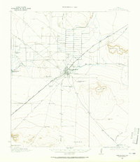
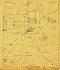
1921 Map of Fort Stockton
USGS Topo · Published 1965About this map
Fort Stockton serves as the focal point of this West Texas survey, situated at a vital desert crossroads where the Kansas City Mexico and Orient railroad intersects with numerous regional tracks like the Old Alpine Road. The landscape is defined by the critical water resources of Comanche Springs and the Leon Springs Reservoir, which supported a burgeoning ranching economy. This agricultural network is clearly mapped through a series of family-named holdings, including the Sachse Headquarters Ranch and Price Headquarters Ranch. Educational outposts such as Leon Valley School and Valley View School appear alongside the rail lines, indicating how the community organized itself around transportation and reliable water. Prominent local landmarks like Sevenmile Mesa and Twelvemile Mesa provide topographic context for these early 20th-century settlements.
Find a feature on this map
27 named features on this map. Tap any name to fly to it.
Don’t see what you’re looking for? This feature index may not catch every label — zoom into the map to look around manually.
Map Details
Editions of this 1921 Fort Stockton Map
This is the sole edition of this map. No revisions or reprints were ever made.
Historical Maps of Fort Stockton Through Time
6 maps found


Featured Locations
- Little Mexico Colonia, TX
- Alamo Ranchettes Colonia, TX
- Bodieville Colonia, TX
- Fort Stockton, TX
- Guild, TX