Loading...
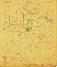
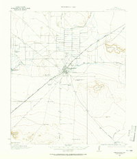
Loading map...1923 Map of Fort Stockton
USGS Topo · Published 1923About this map
Fort Stockton serves as the central hub in this early 1920s survey, where the convergence of the Kansas City Mexico and Orient railroad and historic overland routes like the Old Alpine Road defined West Texas commerce. The presence of Comanche Springs highlights the critical importance of water in this arid landscape, supporting the development of nearby Valley View School and Leon Valley School.
Find a feature on this map
30 named features on this map. Tap any name to fly to it.
Don’t see what you’re looking for? This feature index may not catch every label — zoom into the map to look around manually.
Map Details
Date Portrayed1923
Date Published1923
PublisherU.S. Geological Survey
Map TypeTopographic
Scale1:62,500
Physical Dimensions16.8 x 19.8 inches
Editions of this 1923 Fort Stockton Map
This is the sole edition of this map. No revisions or reprints were ever made.
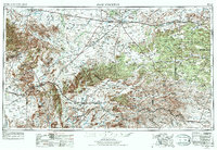
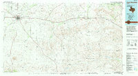
Historical Maps of Fort Stockton Through Time
6 maps found


Featured Locations
- Little Mexico Colonia, TX
- Alamo Ranchettes Colonia, TX
- Bodieville Colonia, TX
- Fort Stockton, TX
- Guild, TX
Source Details
SourceU.S. Geological Survey
CopyrightPublic Domain