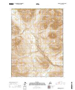
2017 Map of Chandalar D-2 NW
USGS Topo · Published 2017About this map
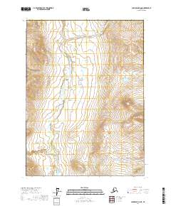
The Yukon-Koyukuk Census Area landscape is defined by high-elevation ridges and isolated alpine lakes in this northern Alaska territory. The map is primarily an orthographic study of terrain, marked by the rigid Public Land Survey System grid including t37n r2w and T36n R1w. The contour data reveals a complex network of drainage basins and peaks, illustrating the topographical character of the Brooks Range region before any significant industrial or infrastructure development. This sheet serves as a clear baseline for environmental researchers and surveyors tracking the natural geography of the Interior.
Find a feature on this map
7 named features on this map. Tap any name to fly to it.
Don’t see what you’re looking for? This feature index may not catch every label — zoom into the map to look around manually.
Map Details
Editions of this 2017 Chandalar D-2 NW Map
This is the sole edition of this map. No revisions or reprints were ever made.
Other maps of this area

1951 · Chandalar
USGS Topo · 1:250,000

1951 · Brooks
USGS Topo · 1:250,000

1956 · Chandalar
USGS Topo · 1:250,000

1956 · Philip Smith Mountains
USGS Topo · 1:250,000

1964 · Chandalar
USGS Topo · 1:250,000

1964 · Philip Smith Mountains
USGS Topo · 1:250,000
1971 · Philip Smith Mountains A-2
USGS Topo · 1:63,360
1990 · Chandalar D-2
USGS Topo · 1:63,360
1990 · Chandalar D-3
USGS Topo · 1:63,360
2017 · Chandalar D-2 NE
USGS Topo · 1:25,000