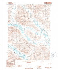
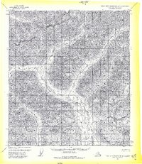
1990 Map of Chandalar D-3
USGS Topo · Published 1990About this map
Arctic National Wildlife Refuge encompasses the eastern portion of this remote interior Alaska landscape, as surveyed in the early 1970s and 1980s. The topography is dominated by the drainage system of the North Fork Chandalar River, which flows through the southern half of the quadrangle. Significant elevation changes are marked by Bend Mountain, while the hydrology is further defined by the winding paths of Your Creek and Our Creek. The map provides a precise look at the wilderness before later modern developments, anchored by the North Boundary Fairbanks Meridian which runs across the northern edge of the sheet. This provisional edition is notable for its lack of roads or trails, illustrating a purely natural river-and-mountain environment in the Brooks Range foothills.
Find a feature on this map
7 named features on this map. Tap any name to fly to it.
Don’t see what you’re looking for? This feature index may not catch every label — zoom into the map to look around manually.
Map Details
Editions of this 1990 Chandalar D-3 Map
This is the sole edition of this map. No revisions or reprints were ever made.
Other maps of this area

1951 · Chandalar
USGS Topo · 1:250,000

1951 · Brooks
USGS Topo · 1:250,000

1956 · Chandalar
USGS Topo · 1:250,000

1956 · Philip Smith Mountains
USGS Topo · 1:250,000

1964 · Chandalar
USGS Topo · 1:250,000

1964 · Philip Smith Mountains
USGS Topo · 1:250,000
1971 · Chandalar C-4
USGS Topo · 1:63,360
1971 · Chandalar D-4
USGS Topo · 1:63,360
1971 · Philip Smith Mountains A-2
USGS Topo · 1:63,360
1971 · Philip Smith Mountains A-3
USGS Topo · 1:63,360