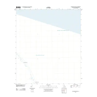
2012 Map of Chandeleur Light
USGS Topo · Published 2012About this map
Chandeleur Islands stretch along the western edge of this coastal survey, forming a delicate barrier between the open waters of the Gulf of Mexico and the shallower reaches of the Chandeleur Sound. Located within Saint Bernard Parish, these landforms represent a dynamic environment where the shoreline is subject to constant change from maritime forces. The map shows the fragmented nature of the islands in the early 21st century, illustrating the narrow strips of terrain that define this part of the Louisiana coast. This region is a significant area for studying coastal erosion and migratory patterns, as the islands serve as a critical buffer for the mainland marshes further west.
Find a feature on this map
3 named features on this map. Tap any name to fly to it.
Don’t see what you’re looking for? This feature index may not catch every label — zoom into the map to look around manually.
Map Details
Editions of this 2012 Chandeleur Light Map
This is the sole edition of this map. No revisions or reprints were ever made.
Other maps of this area

1941 · Horn Island
USGS Topo · 1:62,500

1942 · Horn Island
USGS Topo · 1:62,500

1950 · Dog Keys Pass
USGS Topo · 1:24,000

1950 · Ship Island
USGS Topo · 1:24,000

1951 · North Islands
USGS Topo · 1:24,000

1951 · Chandeleur Light
USGS Topo · 1:24,000

1953 · Mobile
USGS Topo · 1:250,000

1957 · Mobile
USGS Topo · 1:250,000

1957 · Breton Sound
USGS Topo · 1:250,000

1960 · Mobile
USGS Topo · 1:250,000